
Knockacummer [Cnoc an Chomair]
Good walks are even better shared.
Overview
Knockacummer [Cnoc an Chomair]
Knockacummer, a notable Marilyn located in the Sligo Mountains, stands proudly at an elevation of 684 meters. Its impressive prominence of 116 meters offers hikers a challenge rewarded with breathtaking views.
Geology
The hill is primarily composed of sandstone and shales, forming a landscape that tells the geological story of Ireland. As you traverse the routes, keep your eyes peeled for exposed rock layers that offer a glimpse into the ancient past.
Routes
The Knockacummer Loop is the most popular route to the summit. At around 10 km, this moderate hike takes approximately 3.5 hours and showcases the varied landscapes of the area. Starting from the car park near R255134, the path meanders through lush fields and rocky inclines, providing an excellent introduction to this lovely region. Don’t forget your camera; every corner reveals a postcard-worthy vista.
Summit Features
Upon reaching the summit, hikers are greeted by a prominent cairn—a welcoming sight that suggests you've reached your destination. The 360-degree views from the top will take your breath away, with spectacular sights of Benbulbin and the Atlantic coastline on a clear day.
Terrain Type
The terrain is primarily a mix of rugged and grassy paths, interspersed with rocky outcrops that introduce a delightful element of navigation. Ensure you're prepared for slippery conditions, especially after rainfall.
Views
The views from Knockacummer are what many hikers rave about. On clear days, you can spot the majestic Benbulbin to the east and the expansive Atlantic Ocean to the west.
Best Seasons: Spring and summer are particularly vibrant, with blooming flora adorning the hillsides. However, autumn reveals a tapestry of rich colours—perfect for photographers and nature lovers alike.
Hazards
As with many outdoor adventures, a little caution goes a long way. Expect slippery rocks, especially after wet weather, and be mindful of the potentially foggy conditions that can erupt unexpectedly. Navigating muddy paths can also challenge the unsuspecting walker.
Nearby Summits
Knockacummer is not alone in its scenic splendour; nearby are both Benbulbin (496 m) and Knocknarea (327 m), offering additional hiking options for those keen to extend their adventures.
Access
Getting to Knockacummer is a breeze with free parking available at the trailhead. Should you be relying on public transport, local taxis can whisk you from Sligo town, which is about 18 km away.
Facilities
While camping on the mountain is a no-go in terms of facilities, the nearby town of Sligo boasts an array of delightful cafes and restaurants perfect for recharging post-hike.
History
The name 'Cnoc an Chomair' translates to 'Hill of the Junction', a nod to its geographical significance. Historically, this hill has guided many travelers through the Sligo landscape, standing as a silent witness to centuries of exploration.
Happy hiking and remember, it’s not the summit that counts but the stories you gather along the way!
Explore routes near Knockacummer [Cnoc an Chomair]
Public walks starting within 80 km of this hill. Nearby does not mean a route reaches the summit; check its map and access before setting out.
No public routes are currently listed within 80 km of Knockacummer [Cnoc an Chomair] on Walkmates. This does not mean there are no paths here. Explore the map and check local access information before planning a walk.
Route planning notes
These notes describe possible approaches, not verified navigable routes or permission to cross land. Check current paths, local access rules and conditions before setting out.
Knockacummer Loop
A scenic loop starting at the car park, offering hikers a chance to enjoy diverse landscapes.
Make a day of it, together
Find someone to share the walk with, or organise a day out along a route you like.
Hill facts and local notes
Classifications
Elevation
408m
1,339 ft
Prominence
100m
Coordinates
52.2677, -9.0920
R255134
OS Map
72
At the Summit
The summit features a prominent cairn, a beacon for weary wanderers, and offers a stunning 360-degree view of the Sligo landscape.
Terrain & Geology
Knockacummer is primarily composed of sandstone and shales, which are typical of the region. These rocks offer a glimpse into the geological history of Ireland, showcasing sedimentary layers formed over millions of years.
Views & Scenery
From the summit, hikers can enjoy vistas of Benbulbin and the expansive Atlantic Ocean on clear days.
History & Heritage
Name Origin
The name 'Cnoc an Chomair' translates to 'Hill of the Junction', reflecting its position and significance in local geography.
Historical Significance
Historically, the mountain was a landmark for travelers in the region, serving as guidance for centuries.
Getting There & Facilities
Check current local access restrictions, parking rules and transport timetables before travelling. These notes do not confirm public access to the summit.
Parking
Free parking is available at the trailhead near R255134, with sufficient space for several vehicles.
Public Transport
The nearest bus service operates from Sligo town, which is approximately 18 km away, though local taxis are available for a more direct route.
Nearby Facilities
There are no facilities directly on the mountain; however, Sligo has ample cafes, restaurants, and public toilets.
Safety Information
Known Hazards
- Watch for slippery rocks and potential for fog, which can reduce visibility. Muddy paths in wet conditions may also pose challenges.
General Safety Tips
- Check weather conditions before setting out
- Carry appropriate clothing and equipment
- Let someone know your planned route
- Take a map, compass, and GPS device
- Carry emergency supplies: food, water, first aid kit, torch
Hills
Some common questions about the hills answered
Are there group walks up Knockacummer [Cnoc an Chomair]?
Many walkers use Walkmates to join or organise walks with others. You can check for group walks around Knockacummer [Cnoc an Chomair] through the maps
Are there other walkers around Knockacummer [Cnoc an Chomair]?
Activity varies by location and time, but Walkmates lets you see whether others have shared walks or shown interest in this area. Find other people through the walking friends search walking friends for Knockacummer [Cnoc an Chomair] search or of course create your own walk for Knockacummer [Cnoc an Chomair]
Can I organise a walk to Knockacummer [Cnoc an Chomair]?
Yes. If there aren’t any walks listed already, you can create a walk and make it available for others to join.
If you're signed up to Walkmates, you can create a walk to Knockacummer [Cnoc an Chomair].
How do I find a walk up this hill?
There are often multiple ways to walk this hill, depending on experience and route preference. Walkmates helps you explore walks and routes that others have shared.
Can I suggest a new route up Knockacummer [Cnoc an Chomair]?
Yes. You can suggest or create routes to share with others. Walkmates focuses on the social side of walking, so routes are used to help people organise walks and explore areas together, rather than as detailed navigation tools or route libraries.
Other uses really appreciate knowledgeable walkers sharing their routes. Share your favourite route to Knockacummer [Cnoc an Chomair] here
The is an error or something incorrect about this hill. How do I let you know?
We always strive to keep the information on Walkmates as accurate as possible. If you find an error, please let us know through the contact form and we'll aim to correct it as quickly as possible
Community Discussion
Comments
Location
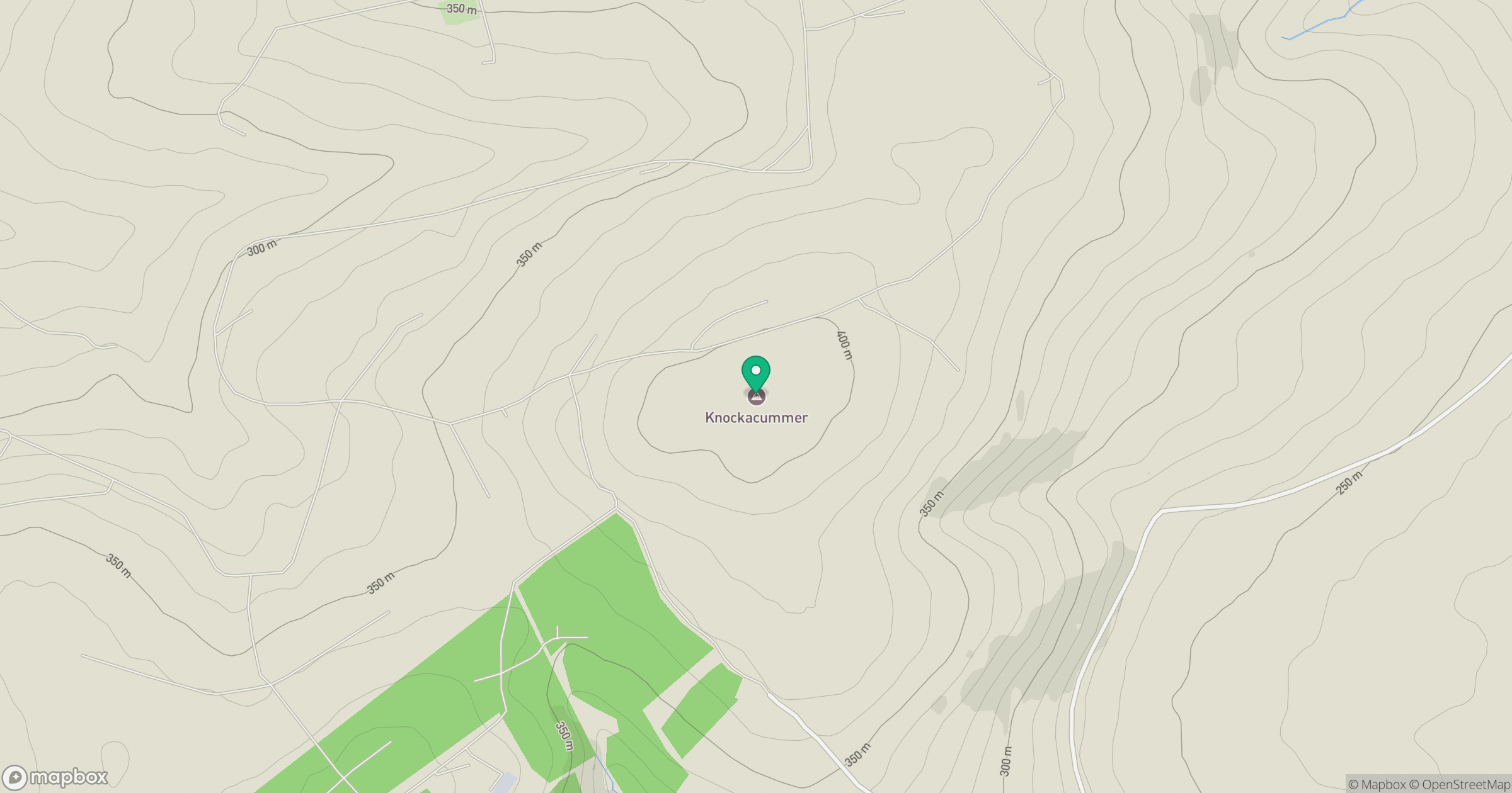
Grid reference: R255134
View on OpenStreetMapOpens a map in a new tab, centred on the hill.
Hills within 30 km
Straight-line distance, not a walking route or confirmation of access.
No comments yet. Be the first.